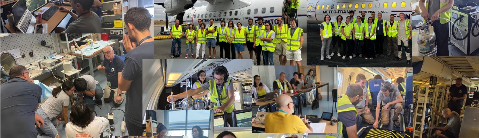
The SILEX campaign is the 1st campaign of the EUBURN-RISK project. It will run from July 15 to August 3, 2025. It involves SAFIRE’s ATR research aircraft equipped with several sensors and instruments to sample and document particle emissions during forest and vegetation fires in southern France. The aim is to prepare for the large-scale EUBURN campaign in 2027 under real-life conditions, both operationally and scientifically. In particular, this involves testing and optimizing airborne operations in real conditions, optimizing the experimental set-up by taking into account real-time satellite observations of fire products and get informations about fires and atmospheric plumes. The campaign will also provide the initial data needed to develop numerical tools and algorithms for inversion of satellite observations. It will also enable to characterize gas and aerosol emissions resulting from fires, the transformations undergone by these aerosols during transport, and to study the microphysical, chemical, hygroscopic and optical properties of aerosols.
Operational Center
The operational website has been active since early June, analyzing conditions and ready to activate ATR flights from July 14. The operational team brings together weather forecasters, Météo-France forecasters specializing in fire risk working in connection with the fire-fighting resources of the French Sécurité Civile, ATC, SAFIRE and scientists involved in the campaign. All information are available on the operational website developed by AERIS (weather forecast, fire risk forecasts, models, satellite image, etc.) to decide aircraft GO/NOGO.
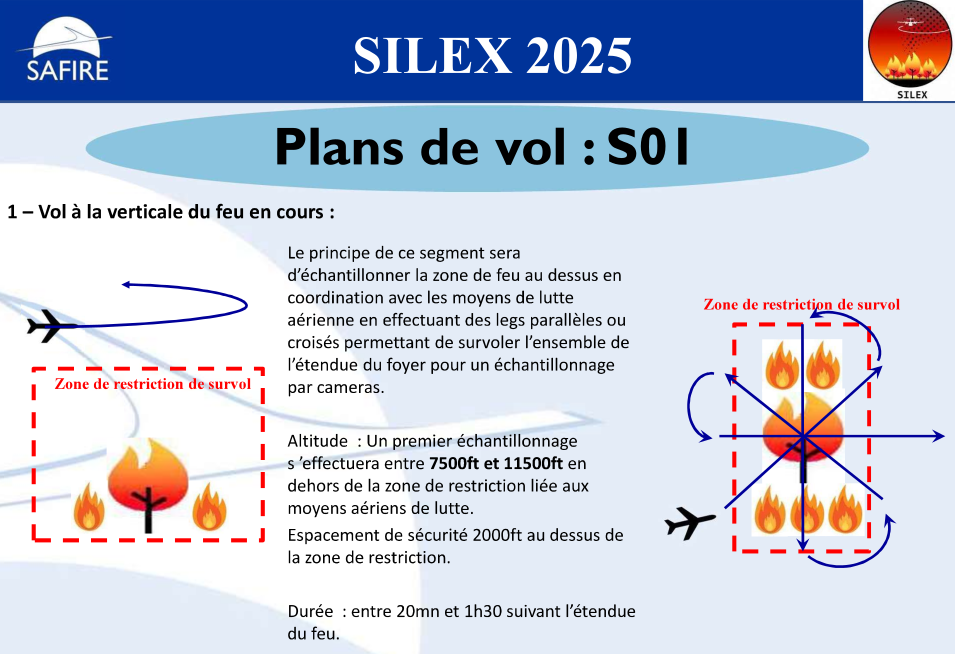
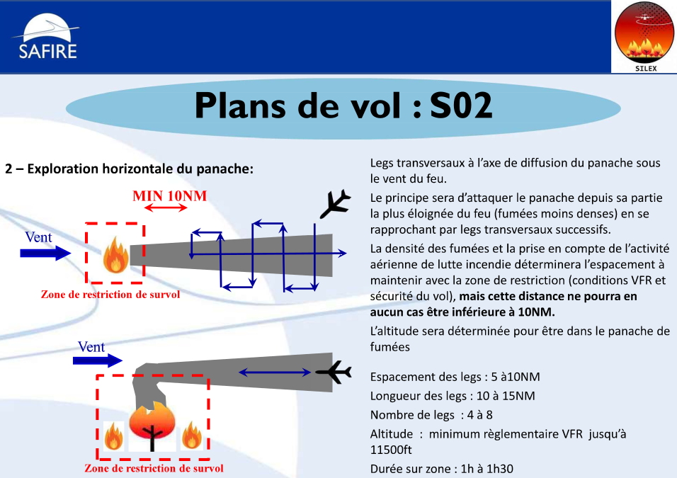
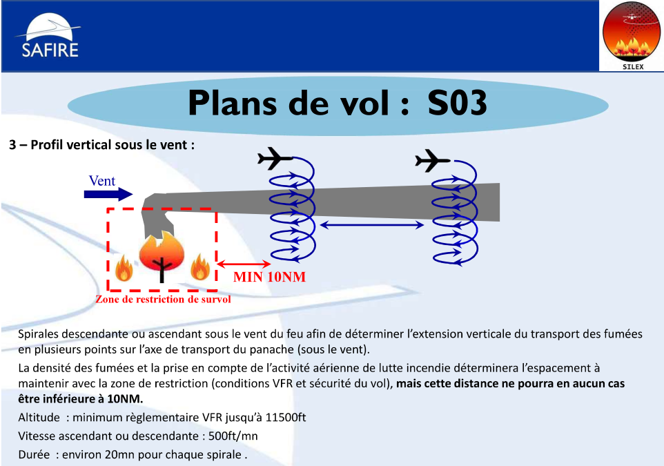
Flight Plans and Strategy
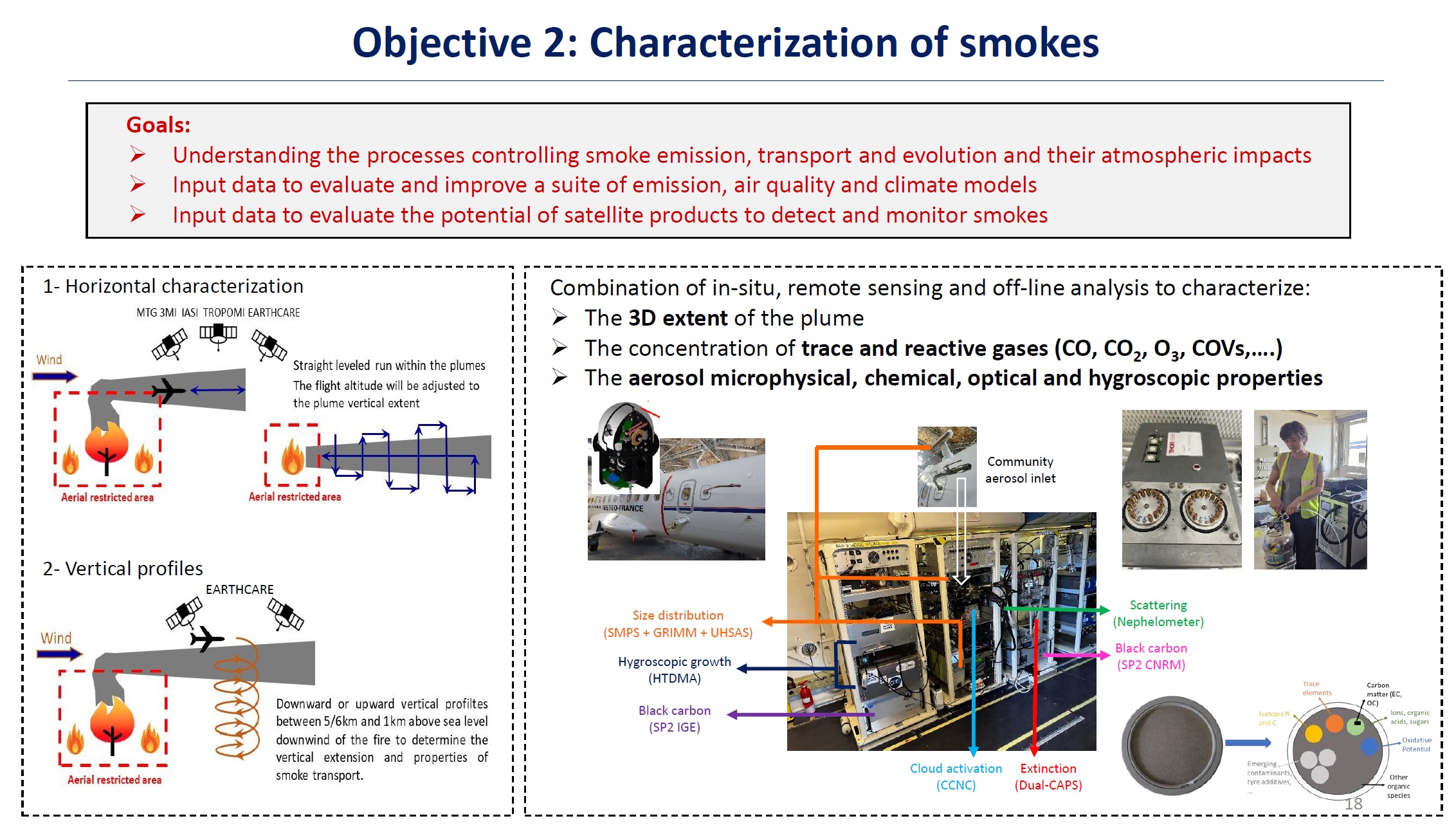
Variables measured and Instruments on board ATR42
| Variable measured | Instrument | Institution |
|---|---|---|
| Standard atmosphere and aircraft state | Various | SAFIRE |
| Broadband solar irradiance | Radiometer and pyranometer | SAFIRE |
| Aerosol number concentration | CPC | CNRM |
| Aerosol number size distribution | SMPS, OPCs, optical wing probe detectores | CNRM+SAFIRE |
| Organic composition in the gas and aerosol phases | MOCCA (CHARON/PTR-TOF-MS) | LaMP |
| Black carbon concentration, size, mixing state | SP2 | CNRM |
| Aerosol activation into Droplets | mini CCN counters | CNRM |
| black carbon morphology and composition | Grid sampling with MET-EDX+tomography | CNRM+Castaing |
| Brown carbon concentration | Dual-CAPS+Nephelometer | CNRM |
| O3, CO, CO2, CH4, H2O | UVabs, CRDS, IR | SAFIRE |
| Aerosol scattering | Nephelometer | CNRM |
| Aerosol extinction | Dual-CAPS | CNRM |
| Vertical dependence of aerosol extinction, AOD | PLASMA | LOA |
| Aerosol and black carbon hygroscopicity | HTDMA-SP2 | CNRM+IGE |
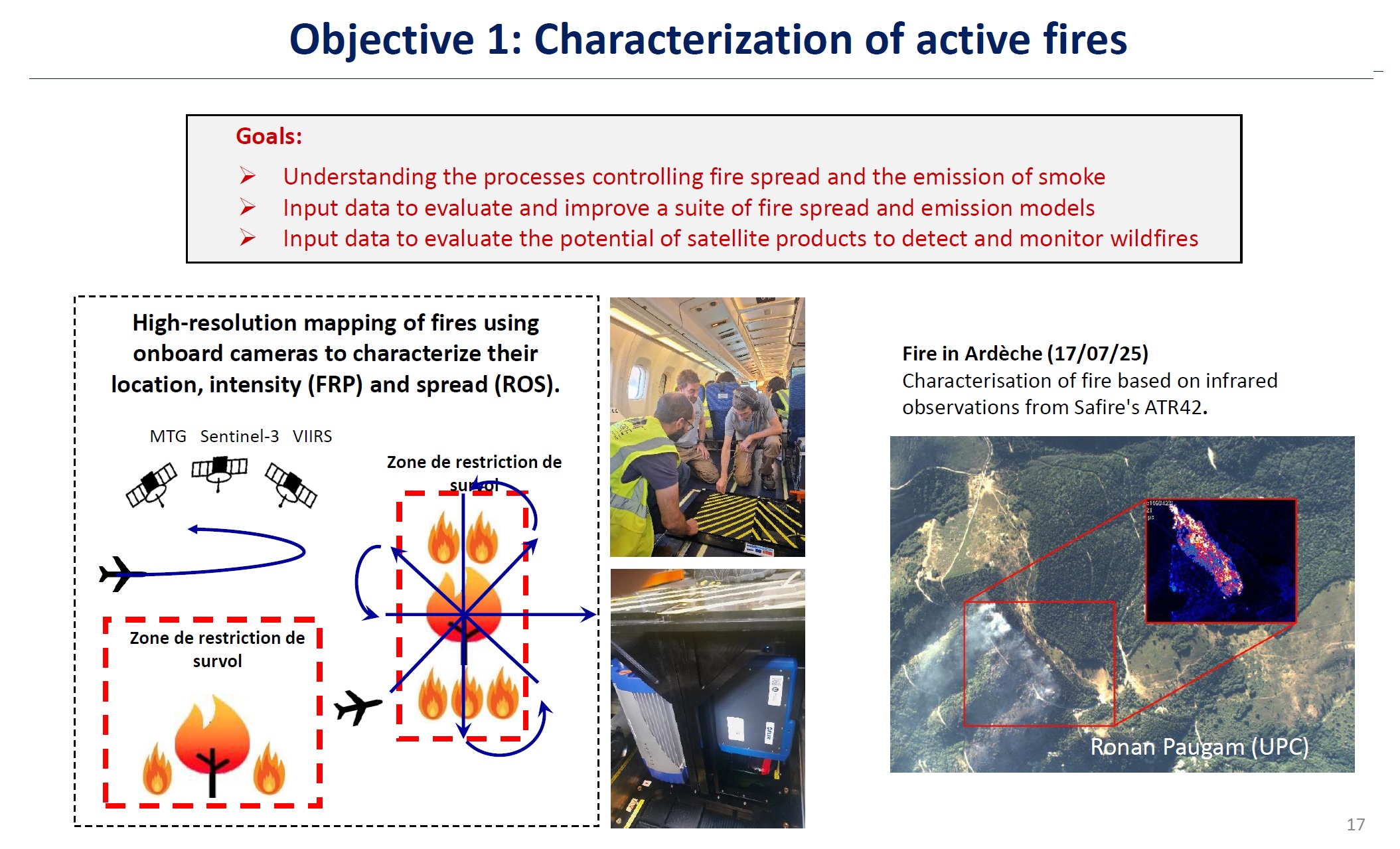
| Fire location, intensity and a spread | IR and UV cameras | UPC+LEMTA |
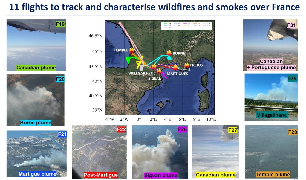
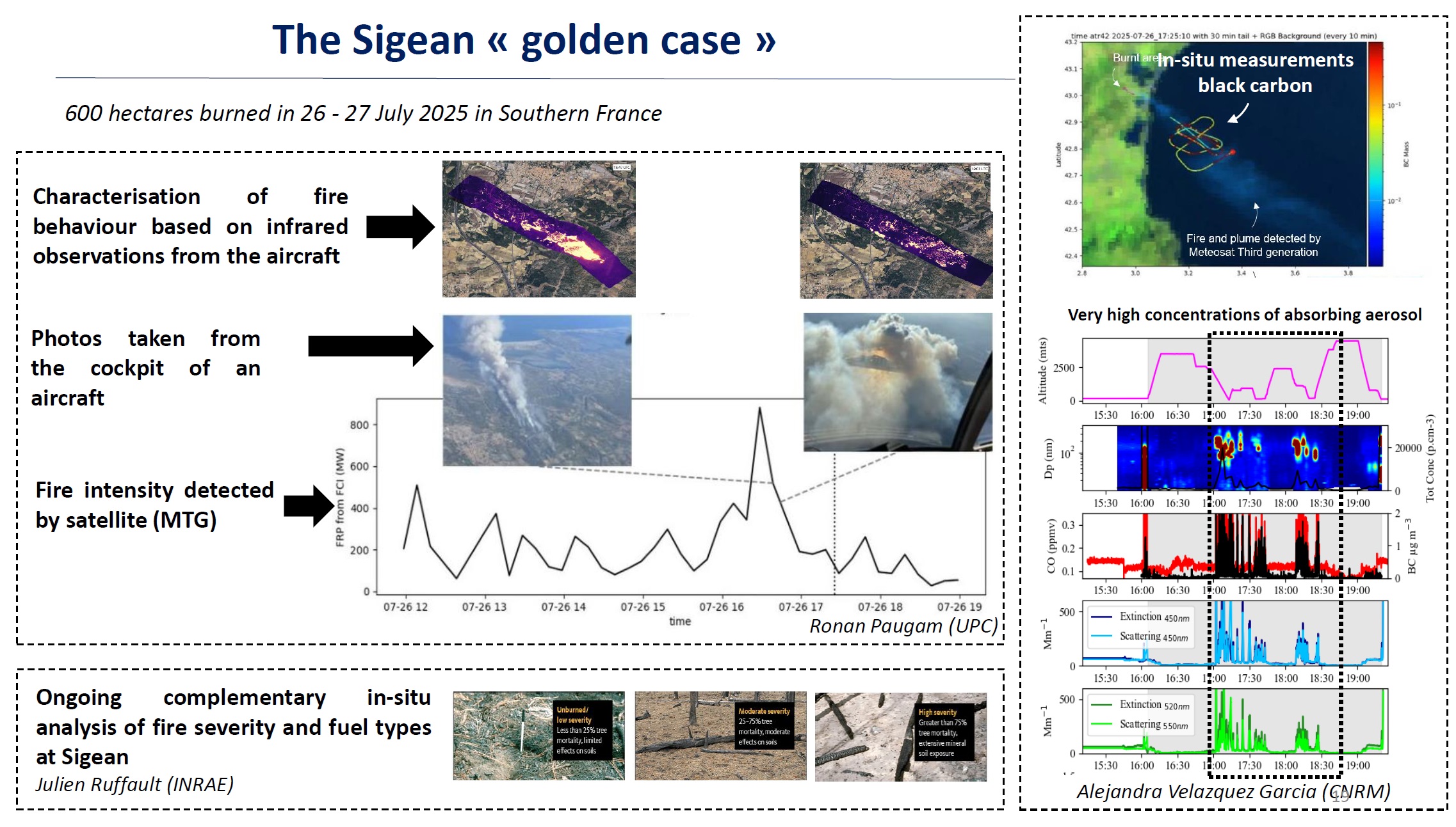
Results